Subnational jurisdictions#
Objective#
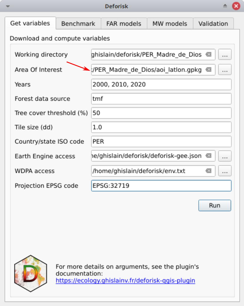
The aim is to obtain a GPKG file named aoi_latlon.gpkg with two layers named aoi for the jurisdiction and subj for the subjurisdictions.
This file can then be used with the deforisk plugin to define the area of interest (AOI).
File creation using QGIS tools#
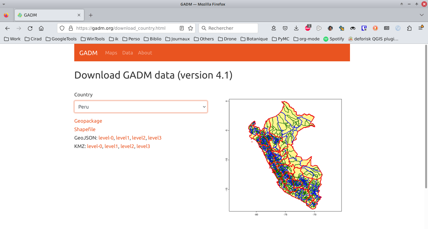
Download country data from GADM using a GPKG file.
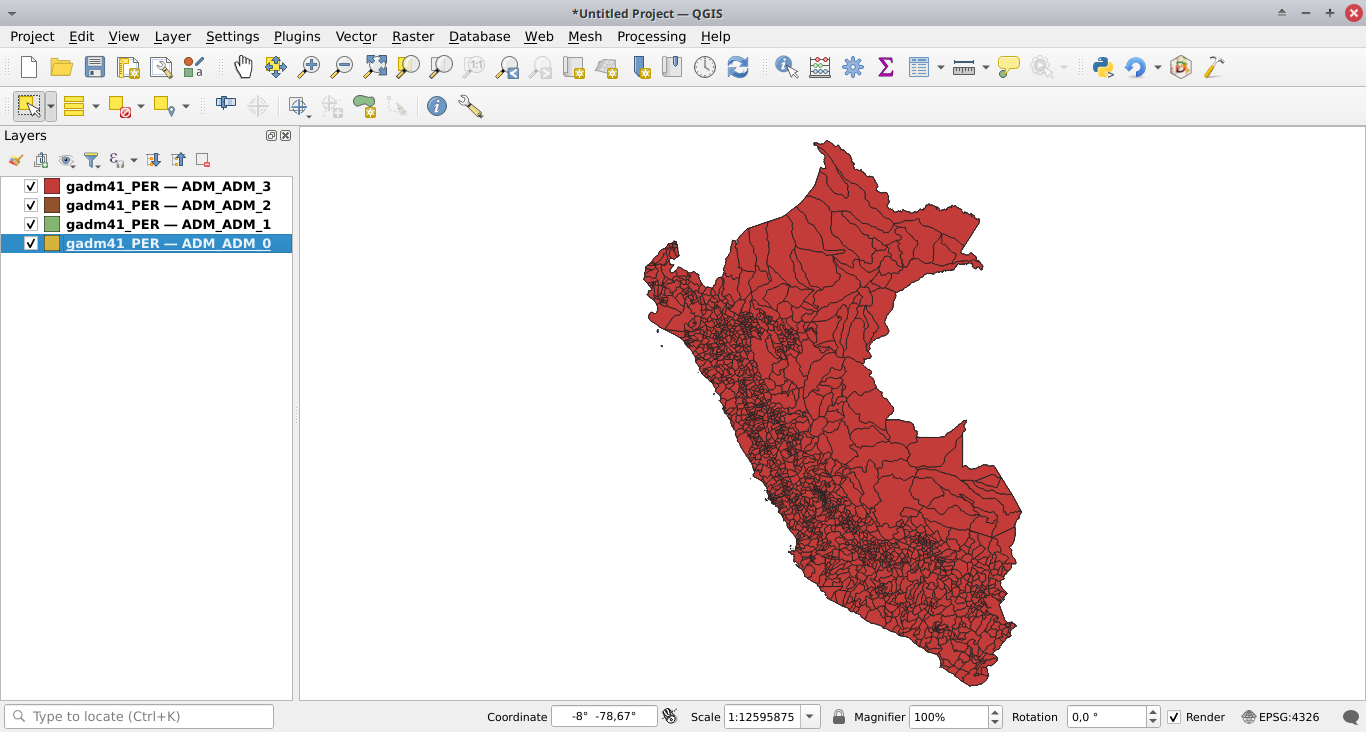
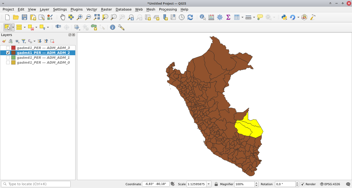
Add all layers from the GPKG file to QGIS.
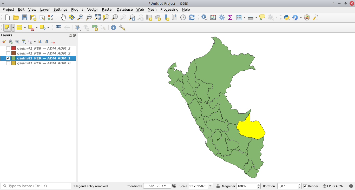
Select the jurisdiction, using the selection toolbar (if the toolbar is not visible, activate it in View > Toolbars > Selection Toolbar).
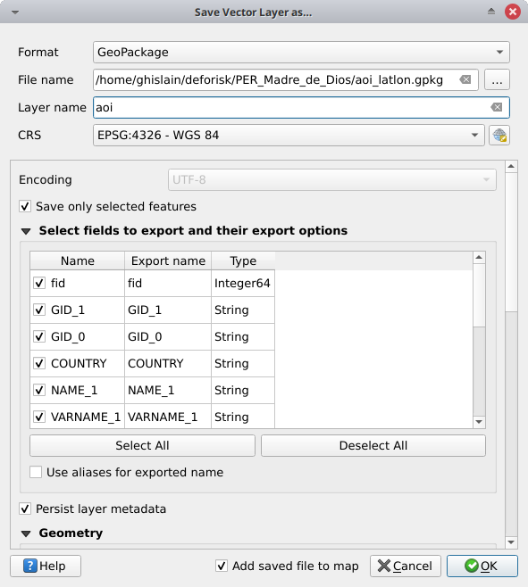
Save the feature in a new GPKG file called aoi_latlon.gpkg right clicking on the layer and selecting Export > Save Selected Feature As. Tick Save only selected features and name the layer aoi (it is mandatory to use this layer name).
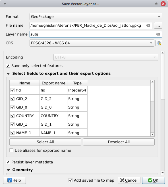
Select the subjurisdictions (to save several features with the selection tool, maintain the Ctrl button pushed).
Save the features in the same GPKG file as previously (aoi_latlon.gpkg) and name the layer subj (it is also mandatory to use this layer name).
We have just created a GPKG file named aoi_latlon.gpkg with two layers named aoi for the jurisdiction and subj for the subjurisdictions.
Note that you can select jurisdiction and subjurisdictions at different administrative levels, selecting features at level 1, 2, or 3 in the GADM dataset.
Looking at the data in QGIS#
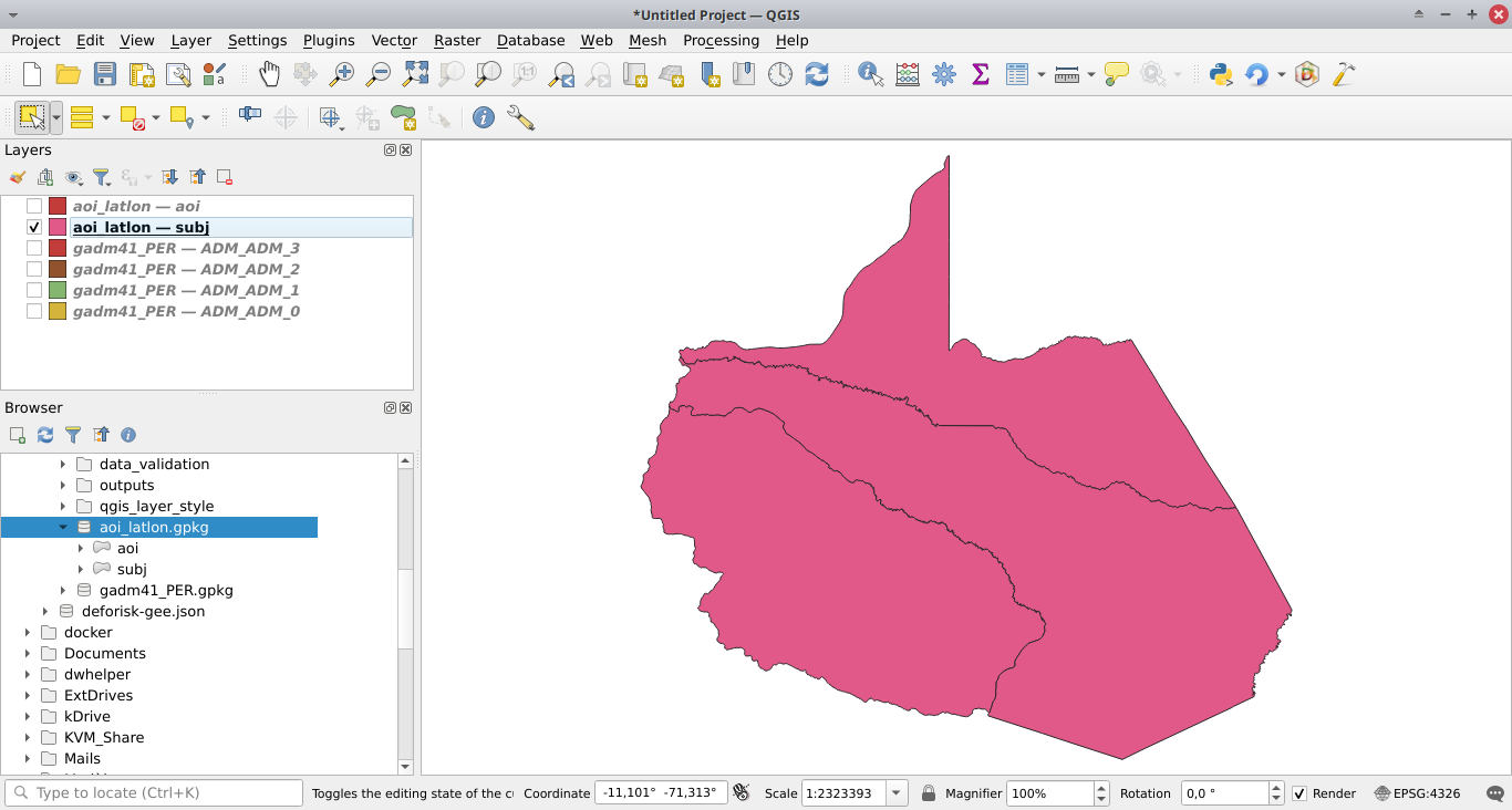
Open the file Browser. If not visible, activate it in
View > Panels > Browser.Search for the
aoi_latlon.gpkgfile in your folders.Drag and drop the GPKG file to add the
aoiandsubjlayers in the list of QGIS layers.
Use with the deforisk plugin#
Select the GPKG file when defining the area of interest (AOI).